Geophysics in Geelong provides a non-invasive lens into the subsurface, enabling engineers, developers, and environmental consultants to map ground conditions without breaking ground. This category encompasses a suite of techniques that measure physical properties — electrical resistivity, electromagnetic wave velocity, seismic wave propagation — to delineate soil layers, bedrock depth, groundwater pathways, and buried objects. In a region experiencing rapid urban expansion, from the Armstrong Creek growth corridor to infill developments in Newtown and Belmont, understanding what lies beneath is not just prudent but often mandatory. These methods reduce geotechnical uncertainty, cut project risk, and support compliance with Australian Standards that govern site investigation practices.
Geelong’s geological framework presents a mosaic of Quaternary alluvial sediments, Tertiary volcanics including the distinctive basalt flows of the Werribee Plains, and weathered Palaeozoic basement rocks. Near the Barwon River and coastal margins, soft estuarine clays and saturated sands pose challenges for foundation design and excavation stability. On the basalt plains, variable weathering profiles and the presence of shallow rock floaters can mislead conventional drilling programs. Geophysical surveys bridge these gaps by providing continuous profiles between boreholes, revealing lateral variations that point-specific sampling misses. This is particularly critical in areas where reactive clay soils — common across the Bellarine Peninsula — drive shrink-swell behaviour that affects residential slabs and light industrial footings.
Australian Standard AS 1726-2017 (Geotechnical Site Investigations) frames the context in which geophysics is deployed locally. While the standard does not prescribe specific geophysical methods, it establishes the requirement for adequate subsurface characterisation, leaving the choice of tools to qualified practitioners. For projects near sensitive receptors — waterways, heritage sites, or existing infrastructure — the Environment Protection Act 2017 (Vic) and the general environmental duty reinforce the need for low-impact investigation techniques. In practice, this means that electrical resistivity and VES surveys are frequently chosen for mapping saline intrusion in coastal aquifers and delineating clay-rich formations, as they respond directly to pore-fluid conductivity and lithology contrasts.
The types of projects that demand geophysical input in Geelong are diverse. Civil infrastructure works — road widening along the Princes Highway, stormwater harvesting schemes, and the duplication of rail corridors — rely on seismic refraction and reflection tomography to establish rippability limits and bedrock topography. Environmental site assessments at former industrial lots in North Geelong or service station sites across Grovedale increasingly turn to GPR survey services to locate underground storage tanks, map fill thickness, and trace utility corridors before intrusive works begin. Even residential developments on greenfield sites benefit from rapid reconnaissance with GPR or resistivity profiling to identify abandoned mine workings or palaeochannels that could affect stormwater infiltration and lot yield.
Quick answers
What ground conditions in Geelong are most challenging for geophysical surveys?
Conductive clay-rich soils, common on the basalt plains and Bellarine Peninsula, attenuate ground penetrating radar signals and reduce GPR penetration depth. Saline groundwater near coastal margins can also mask resistivity contrasts. However, these same conditions often enhance the effectiveness of electrical resistivity imaging and seismic methods, which exploit the electrical and mechanical properties of fine-grained, saturated materials.
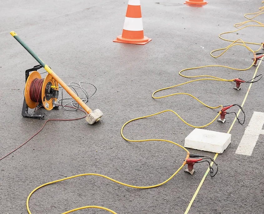
When is a geophysical survey required instead of relying solely on boreholes?
Geophysics is recommended when lateral variability is high — for example, across buried channel deposits, irregular bedrock surfaces, or contamination plumes — where isolated boreholes may miss critical features. It is also required when site access restricts drilling, when working near sensitive structures that cannot tolerate vibration, or when AS 1726-2017 implies a need for continuous subsurface profiling to adequately characterise the site.
How deep can geophysical methods typically investigate in this region?
Depth penetration varies by method and local geology. Electrical resistivity tomography can reach 30 to 50 metres with appropriate array lengths, while seismic refraction typically images to 15–30 metres depending on energy source and geophone spread. GPR penetration in Geelong often ranges from 1 to 8 metres in sandy soils but may fall below 2 metres in conductive clays. Method selection is always tailored to the target depth and ground conditions.
What regulations govern geophysical site investigations in Victoria?
Geophysical work itself is not separately licensed, but the broader site investigation must comply with AS 1726-2017 for geotechnical practice and the Environment Protection Act 2017 (Vic) regarding minimising environmental harm. When works are part of a planning permit or environmental audit, the responsible authority may specify investigation scope. Practitioners should also follow VicRoads and Council guidelines when surveying within road reserves or public land.